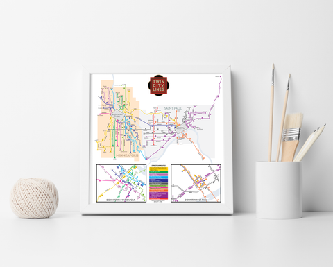
Twin Cities Rapid Transit map print, 1893
The Twin Cities of Minneapolis and St. Paul have been intimately linked for over a century and a half. As early as the 19th century, an enormous streetcar network run by the Twin City Rapid Transit Co. linked the two together. This map is based on an 1893 tour guide book. Of note is that some lines had not yet been converted to electric operation - two of the St. Paul lines at the time were still manual cable cars, similar to those run today in San Francisco. This network survived well into the 20th century, and was only dismantled after World War II.
- Prints are made on satin finish 80# cover stock - 220 GSM in Nashville, Tennessee.
- Image will be printed with a border for framing.
- Please allow five business days for production before it gets shipped out.
- Free standard shipping within the US!
All designs I sell here are made by me! If there's something you'd like custom-made, shoot me a message.